So this is a stand alone post just to run through the Mont Blanc Cross route (or to give it its current name, the Mont-Blanc 23km) as I thought a few people might be interested and it was too much to put in the 2014 post.
This year as I understand it the route is slightly changed both after Argentiere and at the finish section, and so as we walked the 2014 route, there will be some discrepancies, but I will try to make this clear which is the changed bit when writing, and to give as much info as I can about the new route.

This is the 2014 route we were following which shows both the Cross and the Marathon routes and was the only map available on the website!
We walked this route in three sections. The first half we did in one day. the second half was split up due to bad weather and cloud coming in. it wasn't nice to walk in at all so we chickened out (well you know being on holiday and all!)
You can download the new 2015 course in gpx form from the website, and I have loaded this onto my runkeeper account as a reference. The only reason I put it on runkeeper was because if I load it on Garmin it automatically loads to Strava as well, and then FetchEveryone. . .(what? no I am not obsessed with running data, i just like to keep things tidy and can't let go of any of them. . .)
The Race starts on the edge of Chamonix on the landing field for the paragliders.
we had a lovely chat to some of them when we were there. There was a couple from Australia that had travelled specifically to that area to do paragliding in the mountains!
The weather was fairly warm, tshirt weather, but overcast.
we had a lovely chat to some of them when we were there. There was a couple from Australia that had travelled specifically to that area to do paragliding in the mountains!
The weather was fairly warm, tshirt weather, but overcast.
 |
| Starts about here somewhere - thataway! |
Yes its flattish for a while just to let you get your breath together. Then after the first 2km it starts to go up. we took photos at approx 1km intervals, sometimes more, sometimes less.
The route goes from the paragliding field through a local wooded park section, all very pleasant and reasonable but very subtly uphill!
The route goes from the paragliding field through a local wooded park section, all very pleasant and reasonable but very subtly uphill!
 |
| km1, through the woods, pretty nice says Max |
 |
| 1.5km "that way i think" |
 | |||
| 2km by the heli station on the left |
 | |||
| 3km still going slowly up (Kevin checking the map) |
You go through a little pedestrian tunnel, across a river and past the
helicopter base and its no worse than what I'd call an 'Alpine Flat' (eg
looks flat but is going gradually uphill) At 4km you have only gone up
approx 100m
 |
| 4km. going up! |
This soon changes though as you climb out of the woodland park section and start on a mostly uphill, zig-zagging gravel track through the trees (look out for mountain bikers coming down!) - the gradient feels quite relentless in places reaching a peak above La Lavancher at approx 1200m.
Cresting a rise in a little car park you drop into La Lavancher village, winding behind the houses on a little path (we got this a little wrong on our version as we followed the road all the way through the village, but then realised what we should have done!) and then leaving the village on a gently rising track through fields, passing a little toilet hut on the way (just in case you need it!)
Cresting a rise in a little car park you drop into La Lavancher village, winding behind the houses on a little path (we got this a little wrong on our version as we followed the road all the way through the village, but then realised what we should have done!) and then leaving the village on a gently rising track through fields, passing a little toilet hut on the way (just in case you need it!)
 | |||
| 5km and rising |
The next few km undulate up and down between approx 1200 and 1300m through woodland tracks on the
Petit Balcon Nord behind Argentiere until you reach an area just behind the
cable car station. Note Max the dog checking out the route! This is quite a pleasant section as you are in dappled shade for most of it and the dirt tracks are easy to run on, and there are a couple of streams to hop over. When I took a short run on this part later on I found it a very 'feel good' section and as I happily 'skipped' through the trees, even though in reality it was quite hard and I was knackered afterwards! Watch out for the tree roots though.
In searching for more pictures of the Petit Balcon online I came across this youtube video of a chap mountain biking down part of it to just above La Lavancher (the reverse direction to the Cross unfortunately but it give you a good idea - please note he doesn't appear to have to do much pedalling so that is testament to the gradient!)
In searching for more pictures of the Petit Balcon online I came across this youtube video of a chap mountain biking down part of it to just above La Lavancher (the reverse direction to the Cross unfortunately but it give you a good idea - please note he doesn't appear to have to do much pedalling so that is testament to the gradient!)
 |
| 5.5km |
 |
| 6km |
 |
| 6.5km |
 |
| 7km |
 |
| 7.5km downhill |
 |
| 8km, through the woods behind the cable car station |
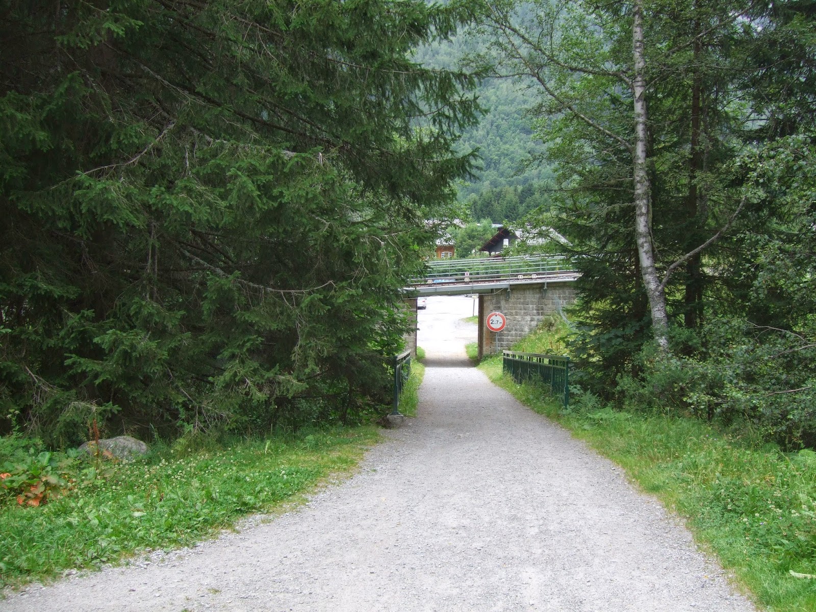
Just before you reach Argentiere at around 7.5km there is a very steep hill (I will be walking this!) which is part of the ski run system, and as you reach the top of the hill you pass under the drag lifts of Les Chosalets beginners area which you can see on the left, then drop steeply downhill again to pass through the woods behind the cable car station - there's another one of the little toilet huts which I think are mainly for Skiers but are really quite delightful for a rural loo - whether they will be open while the race is going on remains to be seen as several hundred runners nipping in may prove to make them a little less delightful!
As you draw level with the back of the village last years route took you left and under the rail bridge (show below), then through the village followed by a zig zag up through woods until you reach the village of Le Planet
 |  |
As you draw level with the back of the village last years route took you left and under the rail bridge (show below), then through the village followed by a zig zag up through woods until you reach the village of Le Planet
 |
| 8.5km |
 |
| not my picture - found on the t'interweb |
The route then follows the original path down a steep road section and across a bridge to Montroc train station.
 |
| 10km |
 |
| 10.5km |
 |
| 12km Montroc Station |
We finished the days hike at the station for convenience sake as we could catch the train back to Argentiere from there.
the strava route for the first half is here, but as you can see at Argentiere it is the 2014 route. Total elevation shown as 556m but that is accumulative
It all doesn't look too taxing does it, but bear in mind the slight constant gradient lifting you from just over 1000 metres to approx 1400 metres at Montroc Le Planet.
2 days earlier as I tried out my first 'Alpine run', as mentioned above, along part of this first half, from Argentiere, and nearly to La Lavencher and back. I took 54 mins to do just under 6km at an average pace of 9:14m/km, compare that to an example of my easy trail pace in the UK of 6.30 - 7m/km ish and you can see how much the altitude really takes it out of you.
The same day as the walk above I tried another flatter alpine run of 6.75km and 53 mins with an average of 7:54m/km. In the Alps it appears that flat is not really flat and this was still really difficult!
So the next morning we returned to Montroc, the weather was a tad colder that the day before and felt a little damp but still pleasant enough for walking in to start with.
We left Montroc station and walked along to where the path climbs slightly above the rail tunnel through the hill that the train would continue into.
Along towards a little village called Tre Le Champ where the first aid station was going to be and a checkpoint, which on race day would have to be reached in a 2.5 hour cut off time. Just up the hill from the village was a road crossing, although we didn't have the benefit of the temporary bridge that would be built just for the runners, it didn't take too long to cross and on the other side the route climbs straight away, up a rocky pathway.
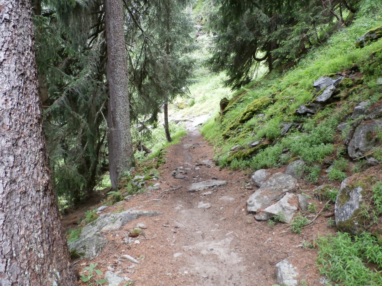
This pathway continues to rise, up through woodland and open hillside until it reaches approx 1700m, so a climb of about 300m in about 2.5km. There's quite a lot of foliage and so if its a warm damp day its a bit like a rain forest in places!
I was so busy concentrating on the climb, which may involve a lot of walking on race day, that i forgot to take another photo until 15km which is near the top of the climb.
the strava route for the first half is here, but as you can see at Argentiere it is the 2014 route. Total elevation shown as 556m but that is accumulative
It all doesn't look too taxing does it, but bear in mind the slight constant gradient lifting you from just over 1000 metres to approx 1400 metres at Montroc Le Planet.
2 days earlier as I tried out my first 'Alpine run', as mentioned above, along part of this first half, from Argentiere, and nearly to La Lavencher and back. I took 54 mins to do just under 6km at an average pace of 9:14m/km, compare that to an example of my easy trail pace in the UK of 6.30 - 7m/km ish and you can see how much the altitude really takes it out of you.
The same day as the walk above I tried another flatter alpine run of 6.75km and 53 mins with an average of 7:54m/km. In the Alps it appears that flat is not really flat and this was still really difficult!
So the next morning we returned to Montroc, the weather was a tad colder that the day before and felt a little damp but still pleasant enough for walking in to start with.
 |
| 12.5km Kevin showing the way to Tre Le Champ |
Along towards a little village called Tre Le Champ where the first aid station was going to be and a checkpoint, which on race day would have to be reached in a 2.5 hour cut off time. Just up the hill from the village was a road crossing, although we didn't have the benefit of the temporary bridge that would be built just for the runners, it didn't take too long to cross and on the other side the route climbs straight away, up a rocky pathway.
 |
| this is just the start of the climb at 13km |
I was so busy concentrating on the climb, which may involve a lot of walking on race day, that i forgot to take another photo until 15km which is near the top of the climb.
 |  |
Around about here as well was this rocky descent shown below, as we drew nearer
to Argentiere again, and this was in my opinion the second most technical
bit of the course. Unfortunately I cant remember exactly where this bit was but from the garmin data wandering about at around 15.25km I'd say it was around there.
The track then went mostly down with more of the same sort of track, rocks, dirt and tree roots, until we were back at a little over 1400m above Les Chosalets once again, but on the other side of the valley.
We pass a trail coming up from Argentiere and continue upwards once again until we reach 17.5km and 1600m, but by this point the weather had quickly changed as it often does on a mountain, and all but the most immediate vicinity was swathed in cloud and fast getting colder. Although it wasn't too far to La Flegere at which point we could have caught a cable car down, we made the decision to abandon the walk at this point as there was a path down to the valley floor where we hoped it was not as cold and wet. Although as you can see Max wanted to go on!
 |
| going down! |
 |
| 16km |
 |
| escape point at 17.5km and the point we returned to the following day |
 |
| 18km |
But then after about a km the track opens onto a shale ski run which takes quite a bit of effort to trudge up, and was a bit demoralising after all the lovely woodland sections. Whether it will look a little more inviting when we get to June 2015 I don't know.
 | |||
| at 18.5km you are faced with this looooong slope. |
 |
| 19km, almost there |
 |
| Flegere looking a bit deserted |
 |
| 19.5km |
But not on the day we did it as you can see. This scree slope can be a bit hairy though!
 |
| 19.75km scree slope crossing |
 |
| This bit as I remember is before the scree slope. |


Unfortunately i cant tell you exactly where they are as i have had to pick these photos from a previous walk (hence the weather improving like magic!) , and my photos are all a little mixed up but i believe they are just after Flegere. Before or after the scree slope I cant work out so it will be a surprise!
The trail drops slightly and goes through a large Alpine field with boulders in at about 21 km and then rises slightly again through trees and just under a chair lift to meet a large ski path.
 |
| 22km |
At this point we followed the old route which was pretty dire as it just followed wide gravel ski paths down and then back up again and the gradient was relentless and tiring, so I'm pretty glad they changed this bit this year.
 |
| this is what it looked like on the day! |
As far as I can tell the new route goes across the ski path and picks up a small track again the other side.
I have some pictures from another days walk which i think capture some of the remaining route, so I will just post them all below so get ready for a weather improvement again!


I think the new path will be so much better than the old path, as the views are great and the trail is much nicer to run on, hopefully the weather will be better than the day we did the course as when we arrived it was like this

A few days earlier it was like this as we watched the para gliders taking off!

Our last section strava data is as below,
however remember this is the incorrect route at the end and the last 2km ish of the new route is like the first 2 km of this walk below (which we did in reverse a few days earlier) it goes up just 100m from 1900 to about 2000. See the big curved shape at the start with the zigzaggy 'V' in the middle? thats the new bit.
I believe that makes the new finish downhill - bonus! Happy running ;-)
No comments:
Post a Comment